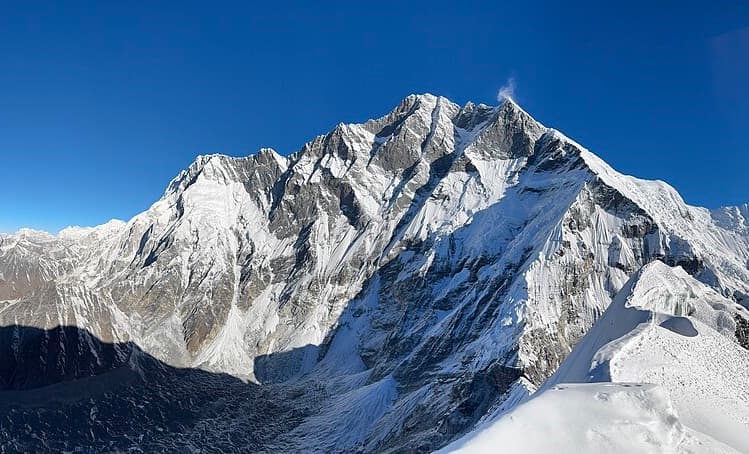
Imja Tse / Island Peak
6,189 m
SOLUKHUMBU DISTRICT

Imja Tse (Island Peak)

"The Island in a Sea of Ice"

Elevation
6,189 m
20,305 ft
Location
Solukhumbu District
Imja Valley
Best Season
Spring & Autumn
Mar–May / Sep–Nov
Standard Route
South East Ridge
Nepal Side

Nepal's Most Iconic Trekking Peak

Imja Tse (Island Peak) was named by Eric Shipton's party in 1953 because it resembles an island in a sea of ice when viewed from Dingboche.

It stands at 6,189 m in the Imja Valley and is the most popular first 6,000m mountaineering objective in Nepal.

Key Highlights

  • Nepal's most popular trekking peak at 6,189 m.
  • Stunning views of the vertical Lhotse South Face, Ama Dablam, and Makalu.
  • Combines perfectly with the Everest Base Camp Trek.

Quick Facts

First Ascent
1953 (Tenzing Norgay et al.)
Parent Range
Mahalangur Himal, Himalayas
Coordinates
27.9245° N, 86.9356° E
Beyond the Basics

Imja Tse (Island Peak): Climbing & Trekking Guide

Route, acclimatisation and permit notes for Imja Tse (Island Peak) from the Nepal Side side, plus practical safety advice.

Imja Tse (Island Peak): Geography and Name

Extends like an island from the ridge dividing the Lhotse and Imja glaciers.

Official height is 6,189 m (20,305 ft).

1953 Expedition: First climbed in 1953 by members of the British Everest expedition (including Tenzing Norgay) as part of training.

Imja Tse (Island Peak): Climbing Routes

Climbed from Island Peak Base Camp at Pareshaya Gyab (5,100 m) or High Camp (5,600 m).

  • South East Ridge Standard Route: Scramble over rocky headwall, cross glaciated headwall with fixed ropes, and scale a steep 45-degree headwall.

Imja Tse (Island Peak): Permits, Season and Safety

The standard season on Imja Tse (Island Peak) is Spring & Autumn (Mar–May / Sep–Nov). Headwall Rush: Bottlenecks occur on the fixed ropes during peak spring and autumn seasons; start early.

Approaches to Imja Tse (Island Peak) begin from Nepal Side in Solukhumbu District, where the main objective is the South East Ridge. Confirm current permit, insurance, and national park requirements before departure.

  • Permits required: NMA Peak Permit & Khumbu Permit.
  • Best months: March to May and September to November.
  • Elevation: 6,189 m (20,305 ft).

Imja Tse (Island Peak): Approach and Acclimatisation

Plan for road travel to the Nepal Side trailhead, then several days of walking before you reach the foot of Imja Tse (Island Peak). Gain height gradually, take a rest day before moving to high camp, and keep a spare weather day in reserve during Spring & Autumn.

Summit day on a 6,189 m objective is long, so start early and set a clear turn-around time. If the South East Ridge is crowded or the snow is unstable, waiting a day is almost always better than pushing on.

Imja Tse (Island Peak): Facts and Figures

Imja Tse (Island Peak) "The Island in a Sea of Ice" stands at 6,189 m in Solukhumbu District, Imja Valley. The figures below summarise the mountain for trip planning.

  • First Ascent: 1953 (Tenzing Norgay et al.)
  • Parent Range: Mahalangur Himal, Himalayas
  • Coordinates: 27.9245° N, 86.9356° E