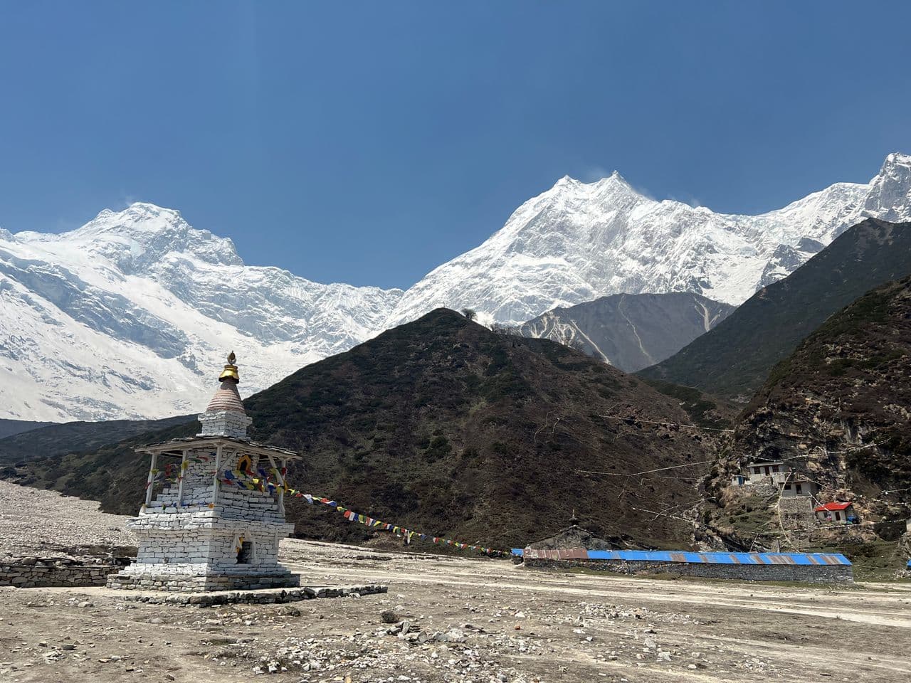
Mount Manaslu
8,163 m
GORKHA DISTRICT

Manaslu

"Mountain of the Spirit"

Elevation
8,163 m
26,781 ft
Location
Gorkha District
Gandaki Province
Best Season
Spring & Autumn
Mar–May / Sep–Nov
Standard Route
Northeast Face Route
Nepal Side

Mountain of the Spirit

Manaslu — 'the mountain of the spirit' — is the eighth highest mountain in the world at 8,163 m, rising from the ridgelines of the historic Gorkha district, the cradle from which modern Nepal was unified.

Known for decades as the 'Japanese Mountain' after the 1956 Japanese–Nepali first ascent, Manaslu has become one of Nepal's most beloved trekking destinations: the Manaslu Circuit climbs through the Manaslu Conservation Area and crosses the dramatic Larkya La to join the Annapurna trail.

Key Highlights

  • Eighth highest mountain on Earth at 8,163 m.
  • Known as the 'Japanese Mountain' — first climbed by a Japanese–Nepali team in 1956.
  • Protected by the Manaslu Conservation Area, prime habitat of the snow leopard.
  • Its circuit over the Larkya La (5,106 m) ranks among Nepal's classic treks.

Quick Facts

First Ascent
May 9, 1956 (Toshio Imanishi & Gyalzen Norbu, Japan–Nepal)
Average Summit Temp
-18°C to -33°C
Parent Range
Mansiri Himal, Himalayas
Coordinates
28.5497° N, 84.5661° E
Beyond the Basics

Manaslu: Climbing & Trekking Guide

Route, acclimatisation and permit notes for Manaslu from the Nepal Side side, plus practical safety advice.

Manaslu: Geography and Name

Manaslu derives from the Sanskrit manasa — 'intellect' or 'soul' — hence 'the mountain of the spirit'. It is also known locally as Kutang.

The official elevation stands at 8,163 m (26,781 ft) in the Mansiri Himal, entirely within Nepal's Gorkha District.

Historical Fact: The Manaslu region stayed closed to trekkers until 1991, and the circuit remains a restricted area today — keeping its trails far quieter than Annapurna or Everest.

Manaslu: Climbing Routes

Manaslu's normal climbing route rises from the very valley walked by the famous circuit trek.

  • Manaslu Circuit Trek: A 10–14 day restricted-area trek from Machha Khola through Samagaun and over the Larkya La (5,106 m) to Dharapani on the Annapurna Circuit.
  • Northeast Face Summit Route: The standard climbing route, first ascended by Toshio Imanishi and Gyalzen Norbu on the 1956 Japanese expedition.

Manaslu: Permits, Season and Safety

The standard season on Manaslu is Spring & Autumn (Mar–May / Sep–Nov). Restricted Area: The Manaslu Circuit requires a Restricted Area Permit and must be organised through a registered agency with a licensed guide.

Approaches to Manaslu begin from Nepal Side in Gorkha District, where the main objective is the Northeast Face Route. Confirm current permit, insurance, and national park requirements before departure.

  • Permits required: Manaslu Conservation Area Project (MCAP) permit & Manaslu Restricted Area Permit.
  • Best months for trekking: March to May (Spring) and September to November (Autumn).
  • Elevation: 8,163 m (26,781 ft).

Manaslu: Approach and Acclimatisation

Plan for road travel to the Nepal Side trailhead, then several days of walking before you reach the foot of Manaslu. Gain height gradually, take a rest day before moving to high camp, and keep a spare weather day in reserve during Spring & Autumn.

Summit day on a 8,163 m objective is long, so start early and set a clear turn-around time. If the Northeast Face Route is crowded or the snow is unstable, waiting a day is almost always better than pushing on.

Manaslu: Facts and Figures

Manaslu "Mountain of the Spirit" stands at 8,163 m in Gorkha District, Gandaki Province. The figures below summarise the mountain for trip planning.

  • First Ascent: May 9, 1956 (Toshio Imanishi & Gyalzen Norbu, Japan–Nepal)
  • Average Summit Temp: -18°C to -33°C
  • Parent Range: Mansiri Himal, Himalayas
  • Coordinates: 28.5497° N, 84.5661° E