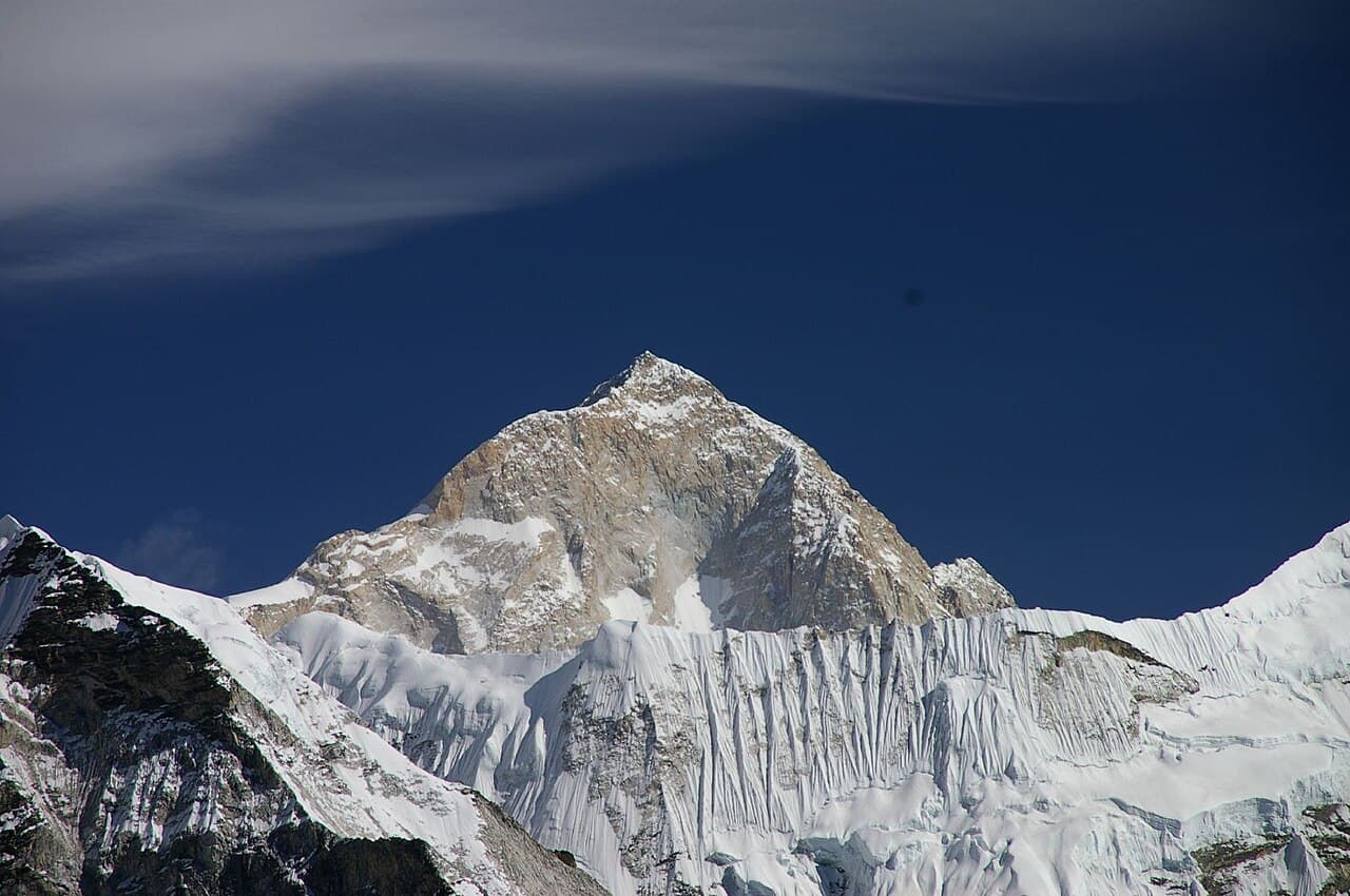
Mount Makalu
8,485 m
SANKHUWASABHA DISTRICT

Makalu

"The Great Black One"

Elevation
8,485 m
27,838 ft
Location
Sankhuwasabha District
Barun Valley
Best Season
Spring & Autumn
Mar–May / Sep–Nov
Standard Route
Northwest Face Route
Nepal Side

The Great Black One

Makalu is the fifth highest mountain in the world at 8,485 m — an isolated, four-sided pyramid of rock and ice standing about 19 km southeast of Everest on the Nepal–Tibet border.

Named after Maha Kala, 'The Great Black One', the mountain is as demanding as it is beautiful — among the most technically difficult of the 8,000 m peaks. Below it, the pristine Barun Valley threads through Makalu Barun National Park, a living museum of forest and glacier visited by only a fraction of Nepal's trekkers.

Key Highlights

  • Fifth highest mountain on Earth at 8,485 m.
  • A near-perfect four-sided pyramid — one of the most striking peaks in the Himalaya.
  • Among the most technically demanding of the 8,000 m peaks.
  • Guarded by the pristine Barun Valley within Makalu Barun National Park.

Quick Facts

First Ascent
May 15, 1955 (Lionel Terray & Jean Couzy, France)
Average Summit Temp
-20°C to -35°C
Parent Range
Mahalangur Himal, Himalayas
Coordinates
27.8897° N, 87.0886° E
Beyond the Basics

Makalu: Climbing & Trekking Guide

Route, acclimatisation and permit notes for Makalu from the Nepal Side side, plus practical safety advice.

Makalu: Geography and Name

Makalu takes its name from Maha Kala — 'The Great Black One' — a fierce Tibetan Buddhist manifestation of Lord Shiva.

The official elevation stands at 8,485 m (27,838 ft), on the border between Nepal's Sankhuwasabha District and Tibet, about 19 km southeast of Everest.

Ecological Fact: The Barun Valley below the peak drops from glacial ice to subtropical forest in barely 40 km, making Makalu Barun National Park one of the most biodiverse places in the Himalaya.

Makalu: Climbing Routes

Makalu has no easy side: its climbing routes are serious undertakings, while the approach through the Barun Valley is one of Nepal's great remote treks.

  • Makalu Base Camp Trek: A remote 18–22 day trek from Tumlingtar up the Arun and Barun valleys to Base Camp at 4,870 m — one of Nepal's wildest long walks.
  • Northwest Face Summit Route: The normal route first climbed by Lionel Terray and Jean Couzy in 1955, rising directly above the Barun Glacier.

Makalu: Permits, Season and Safety

The standard season on Makalu is Spring & Autumn (Mar–May / Sep–Nov). Logistics: The trek starts with a flight to Tumlingtar, which is often weather-delayed. Build in buffer days, and walk with a licensed guide.

Approaches to Makalu begin from Nepal Side in Sankhuwasabha District, where the main objective is the Northwest Face Route. Confirm current permit, insurance, and national park requirements before departure.

  • Permits required: Makalu Barun National Park entry permit.
  • Best months for trekking: March to May (Spring) and September to November (Autumn).
  • Elevation: 8,485 m (27,838 ft).

Makalu: Approach and Acclimatisation

Plan for road travel to the Nepal Side trailhead, then several days of walking before you reach the foot of Makalu. Gain height gradually, take a rest day before moving to high camp, and keep a spare weather day in reserve during Spring & Autumn.

Summit day on a 8,485 m objective is long, so start early and set a clear turn-around time. If the Northwest Face Route is crowded or the snow is unstable, waiting a day is almost always better than pushing on.

Makalu: Facts and Figures

Makalu "The Great Black One" stands at 8,485 m in Sankhuwasabha District, Barun Valley. The figures below summarise the mountain for trip planning.

  • First Ascent: May 15, 1955 (Lionel Terray & Jean Couzy, France)
  • Average Summit Temp: -20°C to -35°C
  • Parent Range: Mahalangur Himal, Himalayas
  • Coordinates: 27.8897° N, 87.0886° E