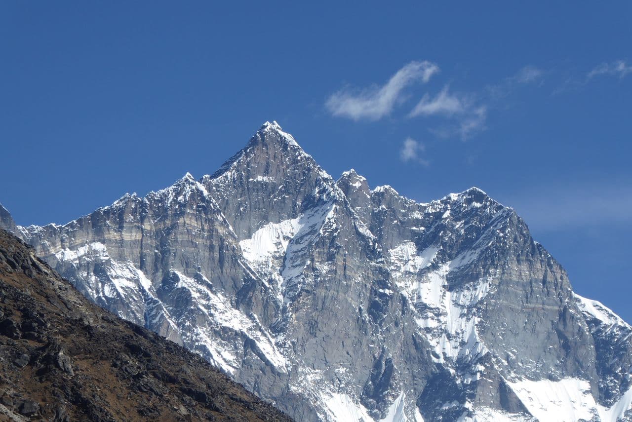
Mount Lhotse
8,516 m
SOLUKHUMBU DISTRICT

Lhotse

"The South Peak"

Elevation
8,516 m
27,940 ft
Location
Solukhumbu District
Khumbu Region
Best Season
Spring & Autumn
Mar–May / Sep–Nov
Standard Route
Lhotse Couloir Route
Nepal Side

Everest's Towering Neighbour

Lhotse is the fourth highest mountain in the world at 8,516 m, connected to Everest by the South Col and rising directly above the Western Cwm on the Nepal–Tibet border. In Tibetan its name simply means 'South Peak' — the great mountain south of Everest.

What Lhotse lacks in fame it repays in drama. Its South Face is a 3,000 m wall of dark rock and hanging ice, one of the steepest big faces anywhere on Earth, while its normal route shares the Everest approach through the Khumbu Icefall — making it a coveted prize for serious high-altitude climbers.

Key Highlights

  • Fourth highest mountain on Earth at 8,516 m.
  • Connected to Everest by the South Col at 7,986 m.
  • Its South Face — a 3,000 m wall — is one of the steepest in the Himalaya.
  • Lhotse Middle (8,414 m) was among the last great Himalayan summits to be climbed (2001).

Quick Facts

First Ascent
May 18, 1956 (Ernst Reiss & Fritz Luchsinger, Switzerland)
Average Summit Temp
-19°C to -36°C
Parent Range
Mahalangur Himal, Himalayas
Coordinates
27.9617° N, 86.9333° E
Beyond the Basics

Lhotse: Climbing & Trekking Guide

Route, acclimatisation and permit notes for Lhotse from the Nepal Side side, plus practical safety advice.

Lhotse: Geography and Name

Lhotse means 'South Peak' in Tibetan — a name earned by its position immediately south of Mount Everest, attached to it by the South Col at 7,986 m.

The official elevation stands at 8,516 m (27,940 ft), with its dramatic South Face forming one of the most imposing walls in the Himalaya.

Did You Know: Lhotse actually has three summits — Lhotse, Lhotse Middle and Lhotse Shar — forming a horseshoe that curves around the head of the Western Cwm shared with Everest.

Lhotse: Climbing Routes

Lhotse is climbed almost entirely along Everest's standard route — the two mountains share the same approach before their paths finally divide.

  • Everest Base Camp Trek (Shared Approach): The world-famous 12–14 day trek through Lukla, Namche Bazaar, Tengboche and Dingboche to Base Camp at 5,364 m — Lhotse shares this approach with Everest.
  • Lhotse Couloir Summit Route: Follows the South Col route through the Khumbu Icefall and the Western Cwm before branching up the famous 1,125 m summit couloir.

Lhotse: Permits, Season and Safety

The standard season on Lhotse is Spring & Autumn (Mar–May / Sep–Nov). Altitude Awareness: Acute Mountain Sickness (AMS) can affect anyone above 3,000 metres. Take mandatory rest and acclimatization days in Namche Bazaar and Dingboche.

Approaches to Lhotse begin from Nepal Side in Solukhumbu District, where the main objective is the Lhotse Couloir Route. Confirm current permit, insurance, and national park requirements before departure.

  • Permits required: Sagarmatha National Park Permit & Khumbu Pasanglhamu Rural Municipality Permit.
  • Best months for trekking: March to May (Spring) and September to November (Autumn).
  • Elevation: 8,516 m (27,940 ft).

Lhotse: Approach and Acclimatisation

Plan for road travel to the Nepal Side trailhead, then several days of walking before you reach the foot of Lhotse. Gain height gradually, take a rest day before moving to high camp, and keep a spare weather day in reserve during Spring & Autumn.

Summit day on a 8,516 m objective is long, so start early and set a clear turn-around time. If the Lhotse Couloir Route is crowded or the snow is unstable, waiting a day is almost always better than pushing on.

Lhotse: Facts and Figures

Lhotse "The South Peak" stands at 8,516 m in Solukhumbu District, Khumbu Region. The figures below summarise the mountain for trip planning.

  • First Ascent: May 18, 1956 (Ernst Reiss & Fritz Luchsinger, Switzerland)
  • Average Summit Temp: -19°C to -36°C
  • Parent Range: Mahalangur Himal, Himalayas
  • Coordinates: 27.9617° N, 86.9333° E