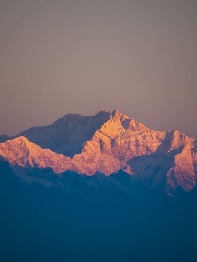
Mount Kanchenjunga
8,586 m
TAPLEJUNG DISTRICT

Kanchenjunga

"The Five Treasuries of the Great Snow"

Elevation
8,586 m
28,169 ft
Location
Taplejung District
Koshi Province
Best Season
Spring & Autumn
Mar–May / Sep–Nov
Standard Route
Southwest Face
Nepal Side

The Five Treasuries of the Great Snow

Rising 8,586 m on the border between Nepal and the Indian state of Sikkim, Kanchenjunga is the third highest mountain on Earth and the easternmost of the Himalayan giants. Its five summits crown a single, glaciated massif of extraordinary scale.

Long held sacred by the local Limbu and Kirat peoples, the mountain is treated with rare reverence: by a tradition dating to the 1955 first ascent, climbers stop a few metres short of the true summit so the peak remains untouched. For trekkers, its remote trails through the Kanchenjunga Conservation Area offer some of the wildest walking in the Himalaya.

Key Highlights

  • Third highest mountain on Earth at 8,586 m.
  • Five summits rising from a single massif — the "Five Treasuries of the Great Snow".
  • Sacred to Limbu & Kirat communities — climbers traditionally stop short of the true summit.
  • Protected by the Kanchenjunga Conservation Area, home to snow leopard and red panda.

Quick Facts

First Ascent
May 25, 1955 (George Band & Joe Brown, UK)
Average Summit Temp
-20°C to -35°C
Parent Range
Kanchenjunga Himal, Himalayas
Coordinates
27.7025° N, 86.9650° E
Beyond the Basics

Kanchenjunga: Climbing & Trekking Guide

Route, acclimatisation and permit notes for Kanchenjunga from the Nepal Side side, plus practical safety advice.

Kanchenjunga: Geography and Name

In Tibetan, the name Kangchenjunga translates to 'Five Treasuries of the Great Snow', while the Limbu people of the region revere the peak as Sewalungma, the mountain to which they offer prayers.

The official elevation stands at 8,586 m (28,169 ft), first measured by the Survey of India in 1856 — remarkably close to modern satellite figures.

Historical Fact: Until the late 1840s, Kanchenjunga was believed to be the highest mountain in the world — the Great Trigonometrical Survey only later proved that Everest and K2 were taller.

Kanchenjunga: Climbing Routes

Two main approaches define Kanchenjunga: the long treks to its base camps on the Nepal side, and the classic climbing line on the Southwest Face.

  • Kanchenjunga Base Camp Trek (Nepal): A remote 20–24 day expedition-style trek from Suketar through Taplejung and Ghunsa, over the Sele La to the North Base Camp at Pangpema (5,143 m).
  • Southwest Face Summit Route: The classic Nepal-side climb up the Yalung Glacier, pioneered by the 1955 British first-ascent expedition.

Kanchenjunga: Permits, Season and Safety

The standard season on Kanchenjunga is Spring & Autumn (Mar–May / Sep–Nov). Remote Country: The Kanchenjunga region is far wilder than the Khumbu — settlements are sparse, some sections are camping-only, and a licensed guide is mandatory.

Approaches to Kanchenjunga begin from Nepal Side in Taplejung District, where the main objective is the Southwest Face. Confirm current permit, insurance, and national park requirements before departure.

  • Permits required: Kanchenjunga Conservation Area Project (KCAP) permit & Restricted Area Permit.
  • Best months for trekking: March to May (Spring) and September to November (Autumn).
  • Elevation: 8,586 m (28,169 ft).

Kanchenjunga: Approach and Acclimatisation

Plan for road travel to the Nepal Side trailhead, then several days of walking before you reach the foot of Kanchenjunga. Gain height gradually, take a rest day before moving to high camp, and keep a spare weather day in reserve during Spring & Autumn.

Summit day on a 8,586 m objective is long, so start early and set a clear turn-around time. If the Southwest Face is crowded or the snow is unstable, waiting a day is almost always better than pushing on.

Kanchenjunga: Facts and Figures

Kanchenjunga "The Five Treasuries of the Great Snow" stands at 8,586 m in Taplejung District, Koshi Province. The figures below summarise the mountain for trip planning.

  • First Ascent: May 25, 1955 (George Band & Joe Brown, UK)
  • Average Summit Temp: -20°C to -35°C
  • Parent Range: Kanchenjunga Himal, Himalayas
  • Coordinates: 27.7025° N, 86.9650° E