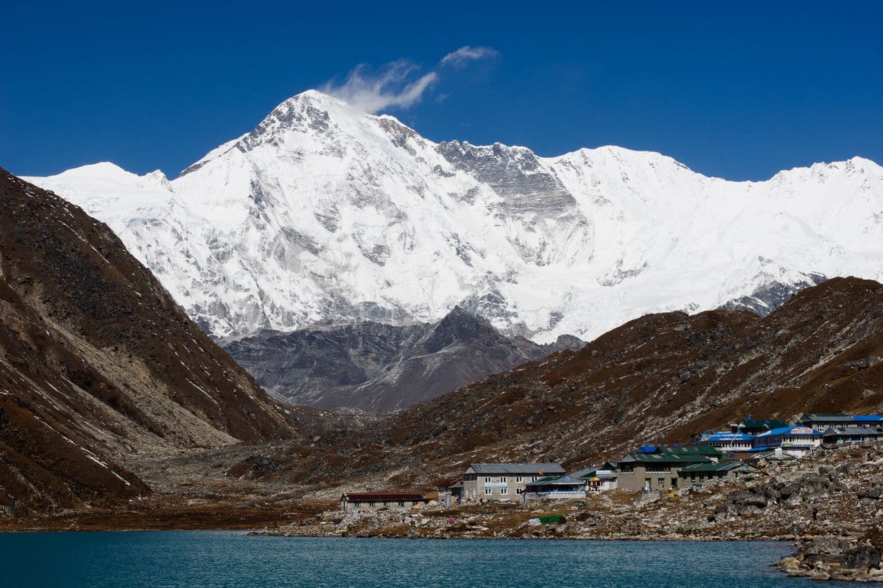
Mount Cho Oyu
8,188 m
SOLUKHUMBU DISTRICT

Cho Oyu

"The Turquoise Goddess"

Elevation
8,188 m
26,864 ft
Location
Solukhumbu District
Nepal–Tibet Border
Best Season
Spring & Autumn
Mar–May / Sep–Nov
Standard Route
Northwest Ridge
Tibet Side

The Turquoise Goddess

Cho Oyu, the sixth highest mountain in the world at 8,188 m, stands just 20 km west of Everest at the head of the Khumbu region, on the border between Nepal and Tibet. Its name means 'Turquoise Goddess' in Tibetan.

With gentle slopes on its standard Northwest Ridge, Cho Oyu is widely regarded as the most achievable of the 8,000 m peaks and is often a climber's first 'eight-thousander'. For trekkers it is the serene guardian of the Gokyo valley, glowing above the turquoise lakes that give it its name.

Key Highlights

  • Sixth highest mountain on Earth at 8,188 m.
  • Widely regarded as the most accessible of the 8,000 m peaks.
  • Guards the Nangpa La (5,716 m) — the historic Sherpa trade route to Tibet.
  • Glowing above the sacred Gokyo Lakes in the Khumbu region.

Quick Facts

First Ascent
Oct 19, 1954 (Tichy, Jöchler & Pasang Dawa Lama, Austria)
Average Summit Temp
-15°C to -30°C
Parent Range
Mahalangur Himal, Himalayas
Coordinates
28.0939° N, 86.6592° E
Beyond the Basics

Cho Oyu: Climbing & Trekking Guide

Route, acclimatisation and permit notes for Cho Oyu from the Tibet Side side, plus practical safety advice.

Cho Oyu: Geography and Name

Cho Oyu means 'Turquoise Goddess' in Tibetan, and Sherpa tradition personifies the peak as one of the goddesses of the Himalaya.

The official elevation stands at 8,188 m (26,864 ft) at the western end of the Mahalangur Himal, guarding the Nangpa La (5,716 m) — the ancient trade pass between Nepal and Tibet.

Historical Fact: Cho Oyu was first climbed on 19 October 1954 by Herbert Tichy, Joseph Jöchler and Pasang Dawa Lama — a rare first ascent of an 8,000 m peak achieved by a small, lightweight team.

Cho Oyu: Climbing Routes

Cho Oyu is climbed mainly from the Tibetan side, while its Nepali flank is graced by the famous Gokyo valley trek.

  • Gokyo Lakes & Gokyo Ri Trek: A 12–14 day Khumbu trek through Namche Bazaar, Dole and the Gokyo valley, with classic sunrise views of Cho Oyu from Gokyo Ri (5,357 m).
  • Northwest Ridge Summit Route: The standard route from the Tibetan side — technically the most straightforward of all 8,000 m climbs.

Cho Oyu: Permits, Season and Safety

The standard season on Cho Oyu is Spring & Autumn (Mar–May / Sep–Nov). Altitude Awareness: Cho Oyu may look gentle, but above 8,000 m there are no easy mountains. Acclimatise properly at Namche Bazaar and Gokyo before any high camp.

Approaches to Cho Oyu begin from Tibet Side in Solukhumbu District, where the main objective is the Northwest Ridge. Confirm current permit, insurance, and national park requirements before departure.

  • Permits required: Sagarmatha National Park Permit & Khumbu Pasanglhamu Rural Municipality Permit (Nepal side).
  • Best months for trekking: March to May (Spring) and September to November (Autumn).
  • Elevation: 8,188 m (26,864 ft).

Cho Oyu: Approach and Acclimatisation

Plan for road travel to the Tibet Side trailhead, then several days of walking before you reach the foot of Cho Oyu. Gain height gradually, take a rest day before moving to high camp, and keep a spare weather day in reserve during Spring & Autumn.

Summit day on a 8,188 m objective is long, so start early and set a clear turn-around time. If the Northwest Ridge is crowded or the snow is unstable, waiting a day is almost always better than pushing on.

Cho Oyu: Facts and Figures

Cho Oyu "The Turquoise Goddess" stands at 8,188 m in Solukhumbu District, Nepal–Tibet Border. The figures below summarise the mountain for trip planning.

  • First Ascent: Oct 19, 1954 (Tichy, Jöchler & Pasang Dawa Lama, Austria)
  • Average Summit Temp: -15°C to -30°C
  • Parent Range: Mahalangur Himal, Himalayas
  • Coordinates: 28.0939° N, 86.6592° E